How drone-based documentation supports insurance reviews, planning, and better decisions
Counties own and operate facilities that carry long-term maintenance, insurance, and replacement costs. When information about these assets is incomplete or outdated, risk increases—and unmanaged risk often shows up as higher premiums, unexpected repairs, and budget surprises. A current asset inventory reduces that exposure.
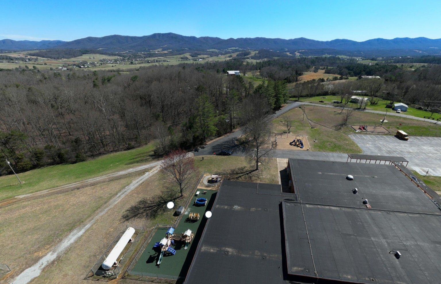
Drones provide a practical way to strengthen asset inventories by capturing up-to-date visuals across many locations in a short amount of time. Instead of relying on scattered photos or repeat site visits, counties gain a consistent desktop-available record that supports risk management, insurance reviews, and planning.
This concept was used in Greene County, where CTAS completed a countywide drone-based inventory of county-operated assets, including:
- public safety facilities
- county offices
- historical structures
- schools
- parks
- solid waste facilities
- fire stations
- emergency management operations
CTAS worked with Greene County’s insurance committee and Commissioner Brad Peters to produce an inventory that directly supported insurance reviews, risk management, and informed decisions.
Each insured site was documented with clear aerial and site-level views, allowing committee members and insurance brokers to review assets remotely and to better understand condition and risk. The information was delivered through an online, map-based system accessible in a standard desktop web browser—no specialized software required.
One immediate result was lower insurance costs, achieved through reductions in both premium and deductibles. Clear, consistent documentation reduces uncertainty around asset condition and exposure, allowing insurers to better evaluate risk.
This pilot project provided a baseline inventory, but if conducted routinely the inventory can function as a digital representation of county assets. Often described in the asset management industry as a “digital twin”, these valuable tools support nor only insurance evaluations but ongoing planning discussions. Digital twins can also aid in emergency preparedness by providing detailed site maps, much better than standard aerial imagery.
As you think about your county’s infrastructure, here are some questions to consider:
- Do we have a current baseline assessment of our county-owned assets?
- Which assets create the most insurance and operational risk today?
- How often should asset information be updated to remain useful?
- What level of documentation improves decision-making without adding staff burden?
Asset inventory is about clarity and control. Drones can help counties reduce risk, improve confidence, and make better decisions—before costs escalate.
CTAS will be conducting similar drone-based asset inventory studies in 2026. If your county is interested in discussing this service, please reach out to your CTAS county government consultant or to Kim Raia, CTAS Environmental Management Consultant, at Kim.Raia@tennessee.edu for more information.